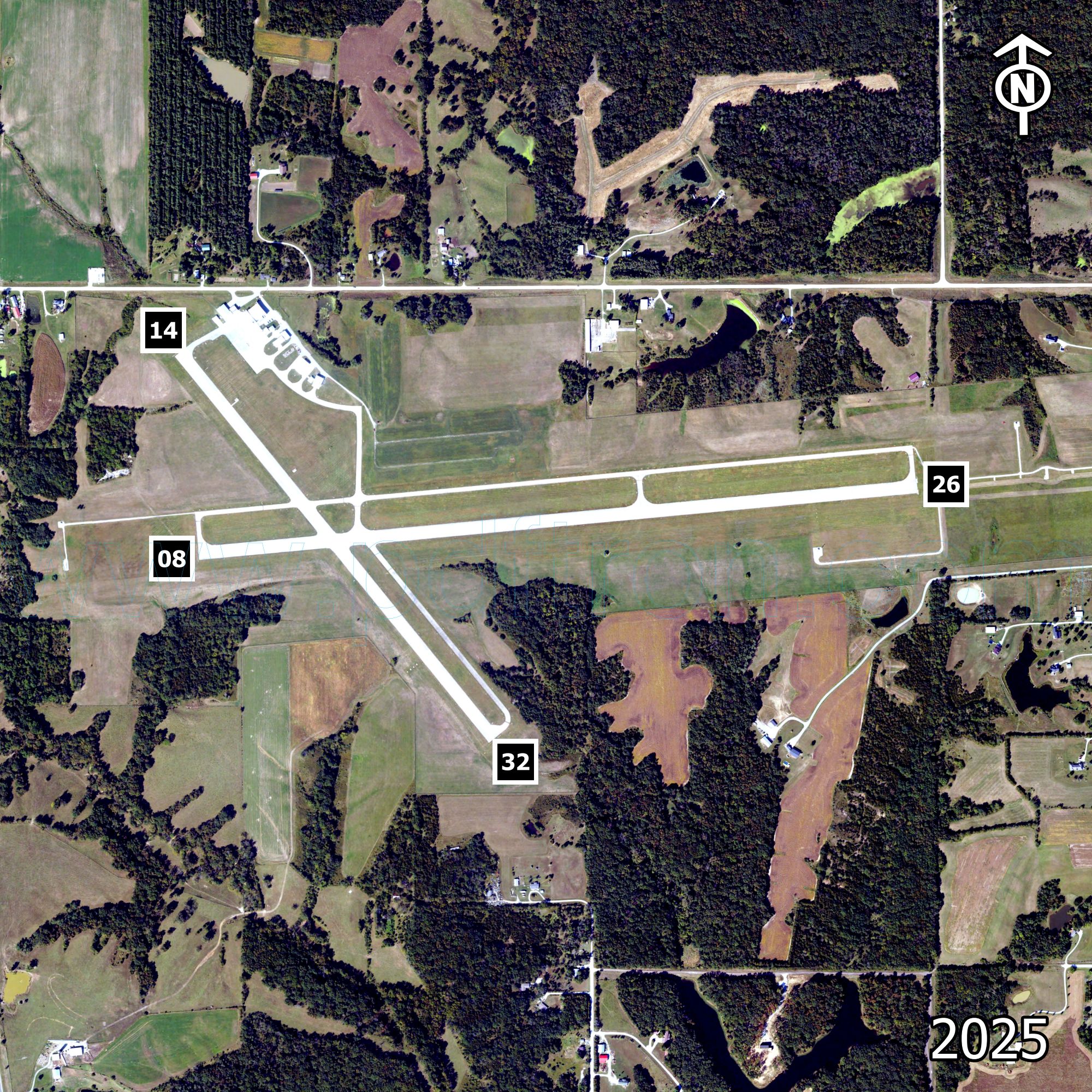
Keokuk Municipal (EOK)
Keokuk
| Runway | Surface | Width | Length | Lights |
|---|---|---|---|---|
| 08/26 | CONC | 100 | 5500 | MIRL |
| 14/32 | CONC | 100 | 3576 | MIRL |
| Approach Lights | VGSI | Pattern |
|---|---|---|
| NONE / MALSR | P4L / P4L | 1500L / 1500L |
| NONE / NONE | V4L / P4L | 1500L / 1500L |
| Manager: | Raymond Ott | (319) 524-6203 |
|---|---|---|
| From City: | 4 miles northwest | |
| Fuel: |
100LL JetA |
|
| Rotating Beacon: | Yes | |
Communications
| CTAF | UNICOM | Lights | Ground Control |
|---|---|---|---|
| 122.800 MHz | 122.800 MHz | 122.800 MHz | - |
| Tower | Approach | Weather | Clearance Delivery |
|---|---|---|---|
| - | 135.520 MHz | 118.375 MHz | 122.125 MHz |
| - | (319) 524-7884 | - |
- Latitude
- 40° 27' 36"
- Longitude
- 91° 25' 43"
- Elevation
- 671 ft. AMSL