Monticello Regional (MXO)
Monticello
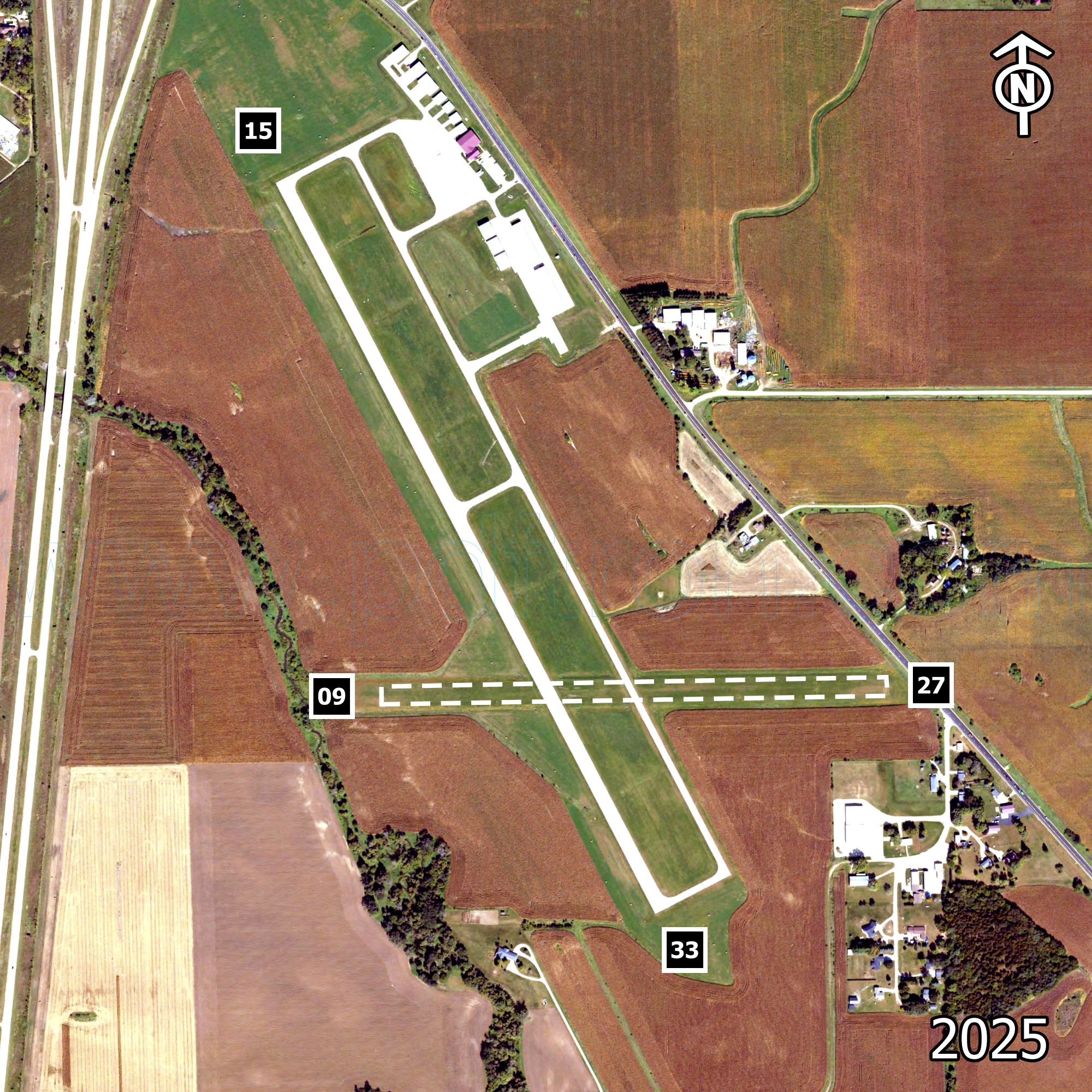
| Runway | Surface | Width | Length | Lights |
|---|---|---|---|---|
| 09/27 | TURF | 90 | 2300 | NONE |
| 15/33 | CONC | 75 | 4400 | MIRL |
| Approach Lights | VGSI | Pattern |
|---|---|---|
| NONE / NONE | NONE / NONE | 1000L / 1000L |
| NONE / NONE | P2L / P2L | 1000L / 1000L |
| Manager: | Brian Ostwinkle | (319) 465-5488 |
|---|---|---|
| Operators: | Monticello Aviation | (319) 465-5488 |
| From City: | 1 mile southeast | |
| Fuel: |
100LL JetA |
|
| Rotating Beacon: | Yes | |
Communications
| CTAF | UNICOM | Lights | Ground Control |
|---|---|---|---|
| 122.800 MHz | 122.800 MHz | 122.800 MHz | - |
| Tower | Approach | Weather | Clearance Delivery |
|---|---|---|---|
| - | 134.050 MHz | 119.275 MHz | - |
| - | (319) 465-6155 | - |
- Latitude
- 42° 13' 13"
- Longitude
- 91° 9' 48"
- Elevation
- 832 ft. AMSL